HiFly Fishing Demo Area
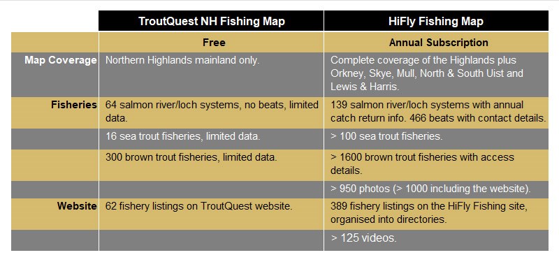
HiFly Fishing Map & Website Features
Watch this 5 minute video for an introduction to functionality and features of the HiFly Fishing Map and Website, and how it provides unique intel on the best fly fishing spots in the Highlands and Islands of Scotland:
HiFly Interactive Salmon & Trout Fishing Map & Fishery Listings
Below is a 'lite' version of the HiFly Fishing map, which shows the top trout and salmon fishing spots for the northern Scottish Highlands mainland area comprising Inverness, Ross-shire, Sutherland & Caithness. This map can be accessed for free on www.troutquest.com. Alongside it, is a sample of the fishing directories for South Sutherland. Move about the map and check out the fisheries to see how it works. Although the demo map is much simpler than the full HiFly Fishing map, the layers and fishery pins are implemented in a similar way.
- South Sutherland Trout Lochs
Lochs Merkland & Ghriama
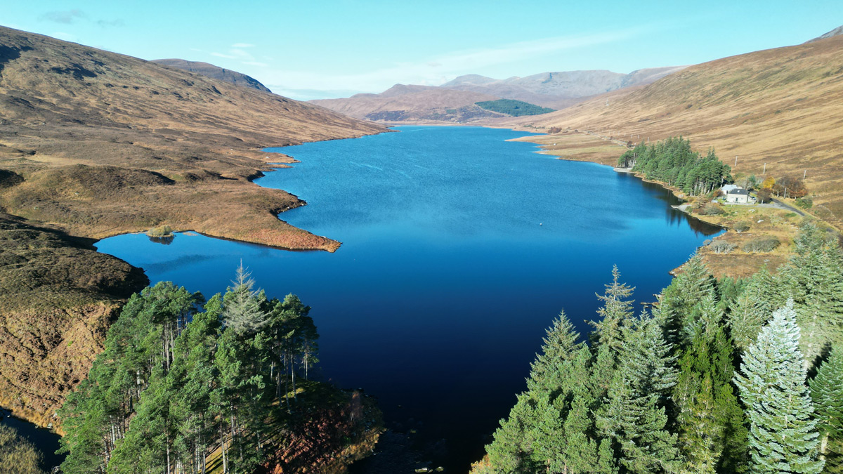 Lochs Merkland & a' Ghriama lie above Loch Shin at the head of the system; Merkland reaching to within ½ mile of the Laxford catchment. Both lochs hold brown trout and Arctic char. The lochs are owned by Merkland Estate, but Lairg Angling Club have recently obtained fishing here.
Lairg Angling Club boat hire from David Ross, Tel: 07768 566691
Loch Shin
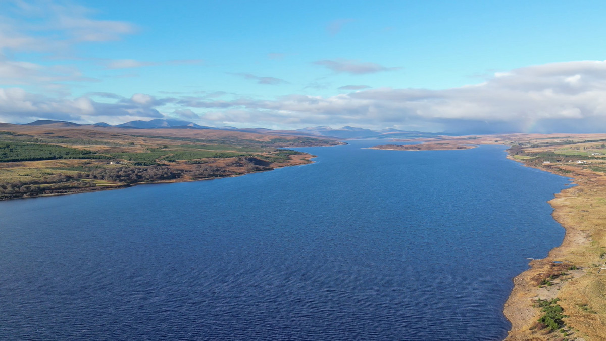 A huge loch, 17 miles (27km) in length, running NW-SE. Trout are typically ½ to ¾ lb, but there are also much larger ferox trout caught regularly. Fly fishing is the norm, but spinning and bait fishing are also allowed. Boat and bank fishing are permitted. Petrol outboards are recommended.
Lairg Angling Club boat hire from David Ross, Tel: 07768 566691
Loch Beannach
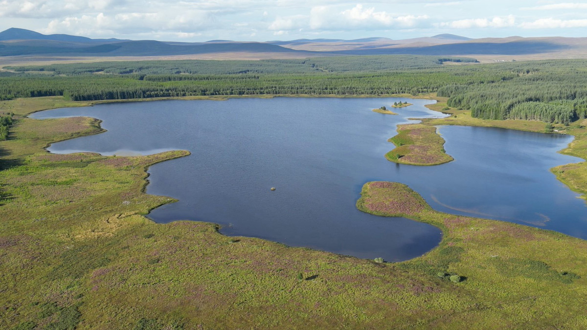 An interesting loch set remotely in forestry plantation to the north of Lairg. Trout are typically ¾ lb to 1 lb with occasionally bigger fish. The main loch is exposed and shallow and there are some hazardous skerries to be avoided, but there is also a sheltered inner harbour that can provide good sport if conditions are difficult. Electric outboards are recommended.
Lairg Angling Club boat hire from David Ross, Tel: 07768 566691
Lochs Craggie & Dola
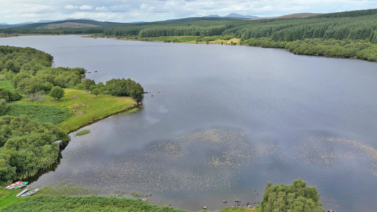 Craggie is recognised as the cream of the Lairg lochs, and the fishing is controlled by Lairg Angling Club. It's famous for both its mayfly hatch and the quality of its trout. These average around the 1 lb+ mark, but many better fish in the 2-3 lb range are caught each season. Fly only, electric motors only.
Lairg Angling Club boat hire from David Ross, Tel: 07768 566691
Lochs Buidhe, Laggan & Laro
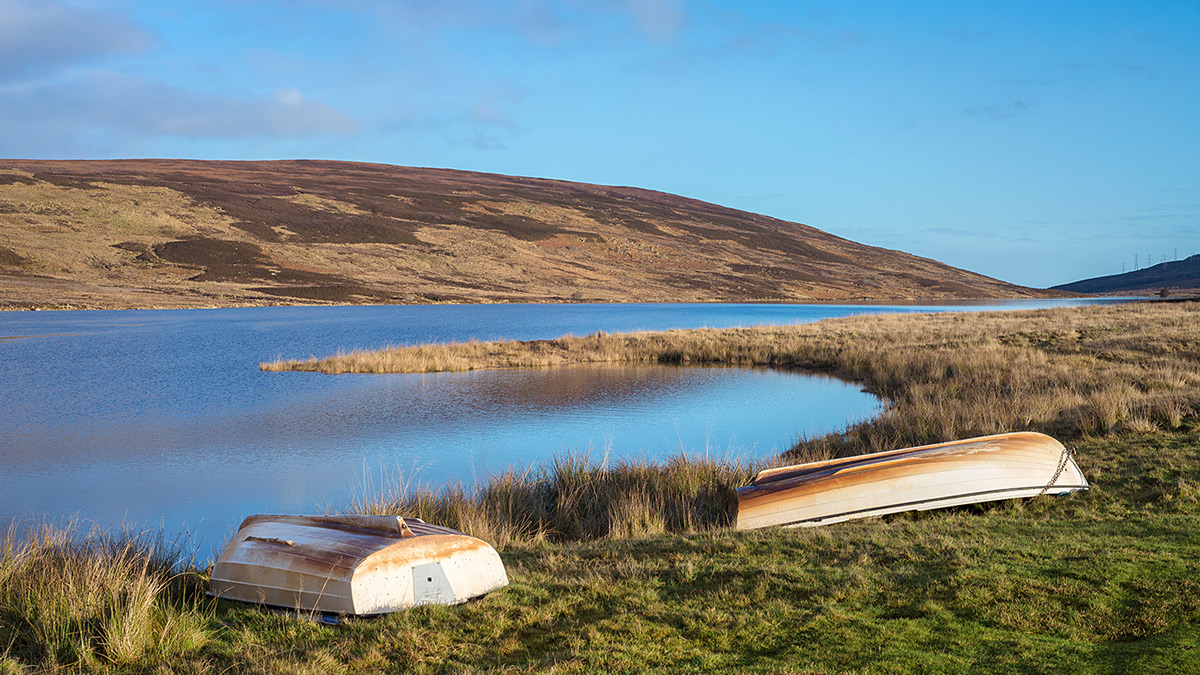 These lochs are clustered on the hills above Bonar Bridge and are controlled by KoSAA. The scenery has been significantly impacted by electricity substations, pylons & power lines, but Loch Buidhe has excellent roadside access, with very light traffic, and offers both boat and bank fishing. Trout average ½ lb. More information from the Kyle of Sutherland A.A. (KoSAA) website.
For permits & boat hire contact Kenny Campbell, based at the old netting station next to the road bridge at Bonar Bridge.
Loch Cracail Mor
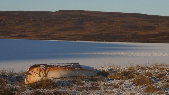 Cracail Mor requires a 1.5 miles 'walk in', but you will leave the electricity transmission infrastructure behind, and it holds good quality trout averaging ¾ lb, and up to 2 lb. More information from the Kyle of Sutherland A.A. (KoSAA) website.
For permits & boat hire contact Kenny Campbell, based at the old netting station next to the road bridge at Bonar Bridge.
Loch Migdale
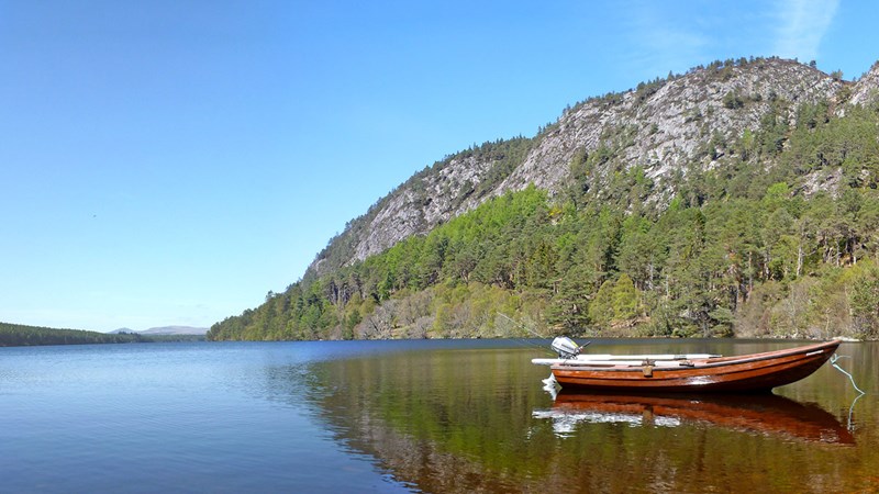 Loch Migdale is a large tree-lined loch lying above the village of Bonar Bridge at the western end of the Dornoch Firth. The loch runs broadly east-west for a total length of 1.8 miles, providing long drifts along the north & south shores. Abundant trout, typically 6-10 oz. More information from the Kyle of Sutherland A.A. (KoSAA) website.
For permits & boat hire contact Kenny Campbell, based at the old netting station next to the road bridge at Bonar Bridge.
Loch Lannsaidh
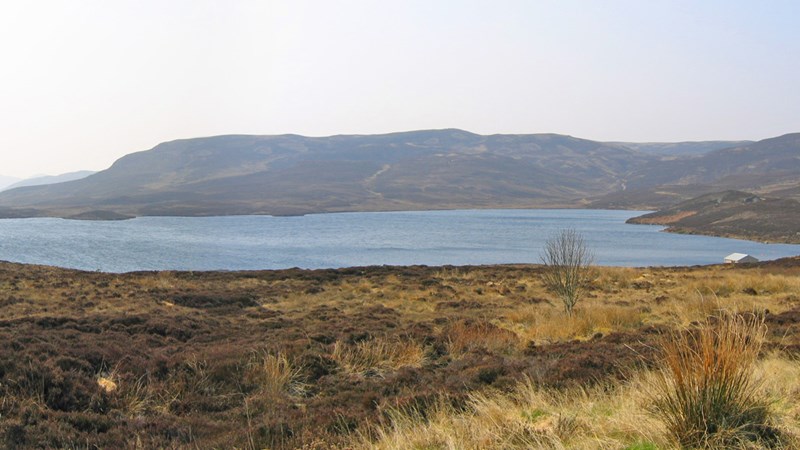 Lannsaidh is the larger of two remote hill lochs lying to the north-west of Dornoch, and managed by Dornoch & District Angling Association. Access is via a gravel track suitable for most vehicles with good ground clearance. In addition to the native brown trout, the club stocks Lannsaidh with rainbow trout, typically 1-2 lb in size.
Permits online from Dornoch & District Angling Association website.
Loch Laiogh
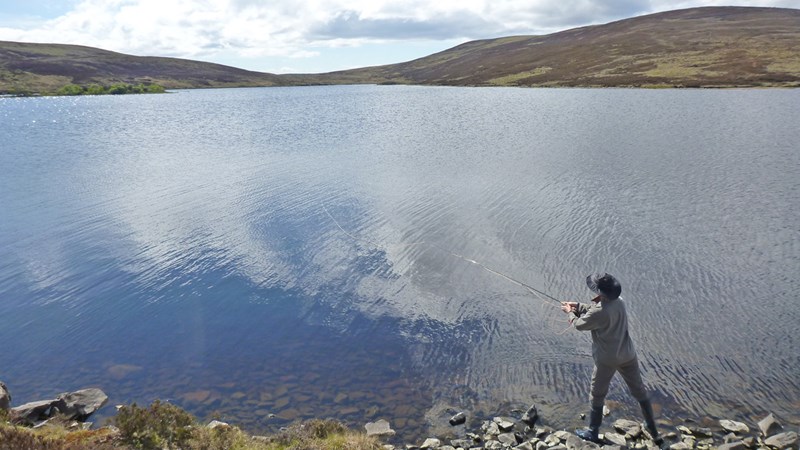 Loch Laiogh lies on the hill above Lannsaidh, and its west end can be reached by a continuation of the same track. The boat however is moored at the east end. Access is via a separate track only suitable for 4x4 vehicles. In addition to the native brown trout averaging ½ lb, the club stocks Laiogh with a few larger browns.
Permits online from Dornoch & District Angling Association website.- River Oykel
Main Season: Mar-Sep 30th. Category: 1
The Oykel is the most prolific of the Kyle rivers and the only one unaffected by hydro schemes. It rises on the southern slopes of Ben More Assynt flowing 6 miles to Loch Ailsh and from there for a further 15 miles to the Kyle at Inveroykel. The main river is split by the Oykel Falls into the Upper and Lower Oykel Fishings.
The Einig tributary joins the main river just below Oykel Bridge, and is formed from 2 sub-tributaries, the Corriemulzie and Rappach Water which are important spawning rivers.
The Oykel Falls and another set of falls 0.5 miles up the Einig are both temperature barriers and spring fishing is restricted to the waters downstream.
Beat Descriptions withheld - demo version only.
- River Cassley
Main Season: Mar-Sep 30th. Category: 1
The Cassley is the smallest of the Kyle rivers and a classic spate river. Its source is a chain of lochs on the north flank of Ben More Assynt. From there the river flows south-east for approximately 18 miles to join the Kyle of Sutherland just downstream from the Oykel at Rosehall.
There are no major hydro schemes on the Cassley but water is diverted from the upper catchment via pipeline to the Loch Shin system. Although the Cassley is provided with minimal compensation flow, the diversion scheme deprives it of much of the benefits of its headwater lochs. Below the diversion weir there are no lochs at all, and the river is therefore prone to very sharp rises and falls in river level.
The Achness (Cassley) Falls are a temperature barrier to migration until the water temperature reaches 11 dec C/52 deg F. Hence all the early spring fishing is in the lowest mile of the river.
Beat Descriptions withheld - demo version only.
- River Shin
Main Season: Apr-Sep 30th. Category: 1
The Shin catchment extends for over 30 miles to the north-north-east. Loch Shin was dammed for hydro-electric power generation in the 1950s and dominates the system at 17 miles in length. The Shin now flows for just 6 miles from below Little Loch Shin to the Kyle. The Falls of Shin half way along its length is a famed viewing point for leaping salmon but also a temperature barrier that salmon typically can't surmount until early-June.
Although water is abstracted via a pipeline from Little Loch Shin for power generation, this has no effect on river levels (apart from the lowermost pool), which benefit from guaranteed compensation flow throughout the season.
Beat Descriptions withheld - demo version only.
- River Carron
Main Season: Mar-Sep 30th. Category: 1
The Carron is the most southerly of the Kyle of Sutherland rivers. It’s a fast flowing medium-sized spate river that flows eastwards for some 25 miles from its source in Wester Ross to the Kyle at Bonar Bridge. On its course it picks up the Alladale and Water of Glencalvie tributaries first, then the Blackwater tributary at Amat. From here the main stem flows through Strathcarron for 9 miles to the Kyle.
There are no hydro schemes on the Carron but water is diverted from the upper catchment via pipeline and aqueduct to Loch Vaich on the Conon system. There are no significant lochs so the river is prone to sharp rises and falls in river level.
Waterfalls dominate the Carron system - particularly the Moral Falls on the middle river (shared by Gruinards and Braelangwell), and to a lesser extent the Gledfield Falls on the lower river (shared by the Gledfield and Cornhill beats). Both are temperature barriers to migration; the former impassable until mid-late April.
Above Amat are the Glencalvie Falls, a significant obstacle to migration, twenty feet in height, that can only be surmounted in very low water; thus often holding back fish in the Amat and Glencalvie beats below.
Beat Descriptions withheld - demo version only.
- Kyle of Sutherland
Main Season: Jun 1st-Sep 30th. Category: 1
The Kyle of Sutherland is the tidal estuary for the rivers Carron, Oykel, Cassley and Shin, beginning at Inveroykel and flowing for about 12 miles before pouring out into the Dornoch Firth at Bonar Bridge. Each of these rivers has a large catchment extending to near the West Coast and is a renowned salmon fishery in its own right. Collectively they rival Scotland’s ‘big 4’ salmon rivers.
The fishing on all these rivers is let weekly as advanced lets, and it is difficult to get day permits. However, there is some very good fishing on the estuary, through which all fish must pass, available from the Kyle of Sutherland Angling Association (KoSAA).
Until 1997 there were as many as 5 netting stations operating from just upstream of the mouth of the Carron to the lowest station a mile downstream, with total catches of up to 10,000 fish per year!
KoSAA - Kyle of Sutherland Estuary
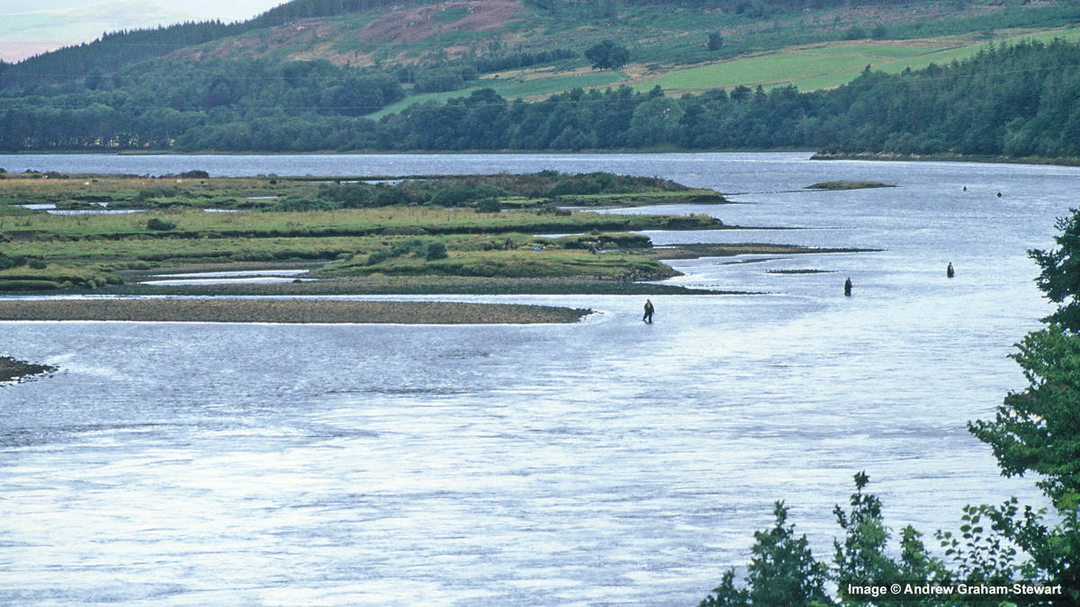 The Kyle of Sutherland estuary reaches to a point about 500m below the bridge at Bonar Bridge. The most popular stretch to fish for salmon, is just upstream of the bridge, but there are other areas of the kyle that can be fished including a section called The Scap, that lies opposite the mouth of the Shin.
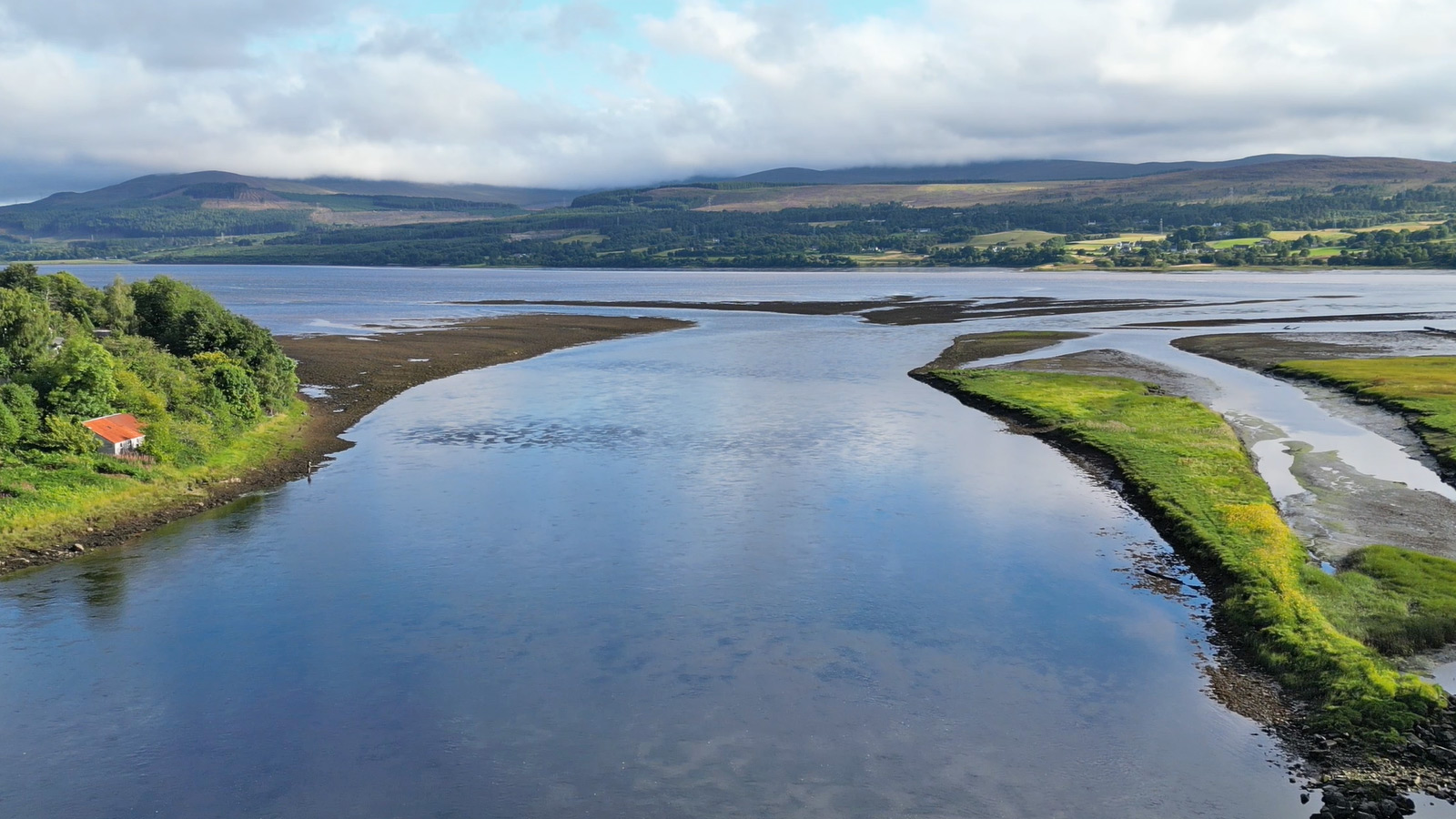 Sea trout only permits are available to fish downstream of the bridge from both banks. More information can be found on the KoSAA website.
For permits contact Kenny Campbell, based at the old netting station next to the road bridge at Bonar Bridge.
Advanced Features of the HiFly Fishing Map & Fishery Listings
Drone & Fishing Videos
There are currently more than 125 videos on the site. There are no intrusive ads or other nasty marketing stuff. Below are short clips from 2 of our drone fly-over/fly-through videos. You can view the embedded videos on the page, or expand them to play in full screen mode at full HD 1920 x 1080 px. If you do so, it will take a few seconds for the video quality to catch up. You can watch more short clips from our river & lochs drone videos here.
Demo Loch Fly-over Clip (Loch Borralan)
Demo River Fly-Through Clip (Upper Shin)
Next Steps
-
- Ready to subscribe? Go to our Subscription page.
